General
What is the project study area?
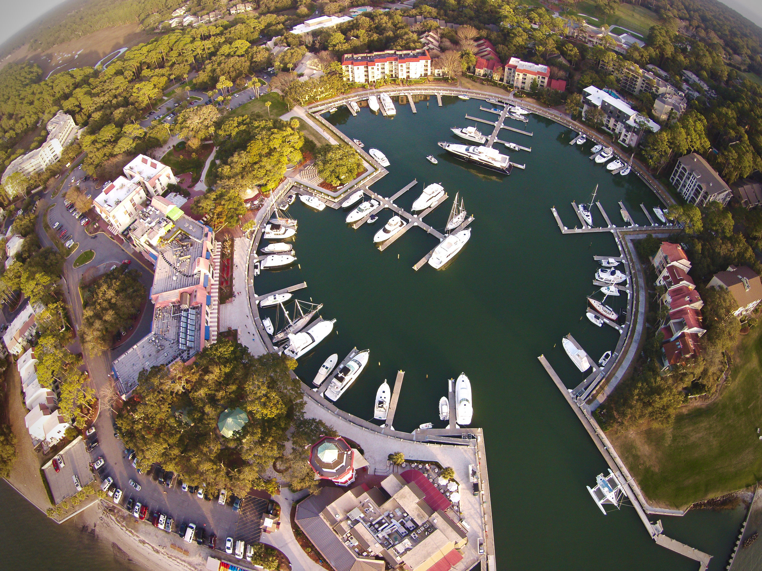
The US 278 Corridor Improvements project runs along the US 278 corridor from Moss Creek Drive in Bluffton to Spanish Wells Road on Hilton Head Island.
What Is being studied as part of this project?
Because the eastbound Mackay Creek Bridge, which crosses the Intracoastal Waterway, would be replaced as a part of SCDOT’s bridge replacement program, Beaufort County has asked SCDOT to partner to take a wholistic approach to studying this critical transportation corridor—US 278 from Moss Creek Drive in Bluffton to Spanish Wells Road on Hilton Head Island. This would improve another key segment of US 278 between I-95 and the Cross Island Parkway.
The purpose of this project is to address structural deficiencies at the existing eastbound Mackay Creek bridge and to reduce congestion within the project limits.
The project is evaluating methods to improve the performance of major intersections along the corridor. The access to Pinckney Island National Wildlife Refuge and the C.C. Haigh, Jr. boat ramp were studied for possible improvements. Cultural and Natural Resources in the area were cataloged and considered when developing the roadway and bridge improvement alternatives.
No. This project is a corridor improvement project, which would likely include modifications to each of the major intersections within the corridor. This may include turning lanes, signals, signs, or other similar modifications on US 278 as well as intersecting roadways to improve mobility throughout the corridor. To better understand the intersections improvements, click here.
Will improvements, or changes, be limited to US 278?
What is the timeline for this project and where are you now?
The full US 278 Corridor Improvements Project is still a priority, but it is currently on hold because of a funding gap caused by rising construction costs. SCDOT and Beaufort County are continuing to explore funding opportunities that could bring the overall corridor improvements project to construction. While the eastbound bridge replacements are moving forward as a separate project, it does not replace the bigger plans to improve the whole corridor. The three-lane bridge replacement is being designed to work with future corridor improvements should funding become available. Learn more about this separate project here.
When can I expect to see construction?
The full US 278 Corridor Improvements Project is still a priority, but it is currently on hold because of a funding gap caused by rising construction costs. SCDOT and Beaufort County are continuing to explore funding opportunities that could bring the overall corridor improvements project to construction.
However, the US 278 Eastbound Bridge Replacement project is moving forward as a separate project and includes the community’s desired improvement at Pinckney Island. Construction of the eastbound bridge replacement is anticipated to begin in 2028, staying in alignment with the original need to replace the aging bridge.
How does SCDOT work with impacted landowners?
SCDOT will work with affected property owners based on third-party property valuations and according to the Uniform Relocation Assistance and Real Property Acquisition Policies Act of 1970. In extraordinary cases or emergency situations, SCDOT may request and FHWA may authorize the acquisition of a particular property or a limited number of properties within the proposed highway corridor prior to completion of processing the Environmental Assessment (EA) and obtaining a Federal Decision. These specialty requests will be handled on a case-by-case basis. If you believe your property may be impacted by this project and you would like additional information, please visit our right-of-way website and review the Highways and You booklet.
Will there be bike lanes or other amenities added to this corridor?
Bicycle and pedestrian improvements are proposed as part of the Modified Recommended Preferred Alternative (RPA), providing a connection between Bluffton, the Pinckney Island National Wildlife Refuge and Hilton Head Island. The Modified RPA follows the existing US 278 corridor through Bluffton and provides improved mobility and access. A 10-foot paved shared-use path would be constructed on the south side of US 278 between Moss Creek Drive and Salt Marsh Drive. The shared-use pathway would then transition to a 14-foot boardwalk facility and then to a 14-foot shared-use path across the new bridge to Jenkins Island. Based on comments from the Town of Hilton Head Island and public support, two scenic lookout points (one over each creek) would be added along the shared-use path if local funding is identified for their design and construction. This multi-use path would also provide access to both the Pinckney Island Wildlife Refuge and CC Haigh, Jr. Boat Landing. On Jenkins Island, the proposed shared-use path would continue under the new bridge, creating a grade-separated pedestrian crossing under US 278, and transition to a 10-foot shared-use path on the north side of US 278. This 10-foot shared-use path would extend all the way to Spanish Wells Road where it would tie into the existing Hilton Head Island shared-use trail facilities. With this addition, the existing sidewalk located on the southside of US 278 would be removed between Windmill Harbor and the Crazy Crab to minimize impacts, particularly along the causeway separating Jenkins Island and Hilton Head Island. A high-visibility pedestrian crosswalk with a pedestrian push button actuated traffic signal that provides extended crossing time will be included at the newly configured Squire Pope Road and US 278 intersection. Since the approval of the EA, a second high-visibility pedestrian crosswalk with a median refuge is proposed at Old Wild Horse Road.
Haven’t you already started this project? Is this not the same project already going on along US 278?
Beaufort County had planned an intersection and widening project on Jenkins Island, but the project and funds have been included now in the overall corridor improvement project.
The noise analysis was completed in accordance with the Federal Highway Administration’s (FHWA) regulations, the Modified Recommended Preferred Alternative would have noise impacts at 12 residential locations within the study area by the year 2045. The noise analysis also indicated that eight of these 12 residential properties would have noise impacts in 2045 even if the proposed project was not constructed.
A noise mitigation analysis was conducted at each impacted location to determine if a noise barrier or other mitigation measure were appropriate to reduce future noise levels. None of the impacted receivers satisfied the feasible and reasonable criteria, which looks at a number of items such as cost, number of receptors, noise reduction goals, and access and are further outlined in the SCDOT’s Traffic Noise Abatement Policy; therefore, no noise barriers are proposed as part of the project.
WAS A NOISE ANALYSIS COMPLETED FOR THE PROJECT?
The Stoney community is one of Hilton Head Island’s historic Gullah communities, which also include the nearby communities of Squire Pope, Spanish Wells, Jonesville, and Jarvis. Oral history interviews with longtime residents, archival research, and historical landscape analysis suggest that Stoney remains central to the Gullah identity through its long history of Black landownership; as a cultural gateway to the island; and as a place of progress, prosperity, and education for the island’s Black community. It is thus recommended eligible for listing in the National Register of Historic Places (NRHP) as a Traditional Cultural Property (TCP).
As outlined in Chapter 3 of the Environmental Assessment of the US 278 Corridor Project documentation, alternatives were considered that completely avoided impacting the Stoney community but resulted in high impacts to natural resources. Additional alternatives were evaluated that made new “cuts” through the Stoney community in areas that are presently undisturbed and resulted in increased relocations.
The TCP report was reviewed by the Gullah Geechee Cultural Heritage Corridor Commission and comments were provided to the State Historic Preservation Office (SHPO) that supported a “No Adverse Effect” determination. Since SHPO’s concurred with the “No Adverse Effect” determination, the project team has identified methods to further minimize impacts to the Stoney community, including the reduction of lane widths to decrease the right-of-way necessary within Stoney.
The Recommended Preferred Alternative 4A (part of the full US 278 Corridor Improvements Project) shown at the public hearing in July 2021 would involve the acquisition of approximately 4.87 acres of new right-of-way and the relocation of two commercial establishments from within the TCP boundary, constituting roughly one-and-a-half percent of the acreage of the entire TCP area. The Modified Recommended Preferred Alternative minimizes potential impacts and would only require the acquisition of 3.47 acres from the TCP.
While mitigation is not required for actions determined to have “No Adverse Effect,” the project proposes community enhancements to preserve and highlight the history of the Stoney community, as described in Chapter 4.4.2 of the Environmental Assessment. The potential community enhancements were developed through coordination with the Stoney community and are based on the recommendations presented in the Background and Recommendations Report for the Gullah Geechee Cultural Preservation Project. Furthermore, Chapter 4.4.2 of the Environmental Assessment outlines the numerous meetings the project team held with the Stoney community, Gullah stakeholders, and the Town of Hilton Head Island as well as the letter received from the Gullah-Geechee Cultural Heritage Corridor Commission.
It is the project’s goal to provide community enhancements to preserve and highlight the history of the Stoney community. Potential enhancements to further establish or reestablish the Stoney community as a “gateway” and a “place” include:
Signage to identify the Stoney community and provide a clear “gateway” entrance/exit to the community based on the boundary established in the Traditional Cultural Property Report
Open-air pavilion on town-owned property along US 278 and Squire Pope Road intersection to highlight the history of the Stoney community and other Gullah neighborhoods on the island
Create a theme-based street and multi-use path lighting
Install flags/signage to the lighting poles along US 278 to indicate they are within the Stoney community
Landscaping along US 278 within the Stoney community
Seating along the multi-use path
Develop an online, interactive map of the history of the Stoney community to share important historical information about it, Gullah Communities, and Hilton Head Island
Improved access to the Jenkins Island Cemetery.
HOW IS THE PROJECT PROPOSING TO PRESERVE GULLAH HERITAGE?
Alternatives & Traffic Analysis
ARE THERE MORE AESTHETICALLY PLEASING OPTIONS FOR SAFETY, OTHER THAN THE TYPICALLY USED “JERSEY BARRIER,” FOR BRIDGE RAILINGS?
Jersey Barriers are the only known products adopted by SCDOT to meet MASH crash test criteria for the potential speed limit under consideration for this structure. However, SCDOT will research and consider new options that adhere to the crash requirements. If a multiuse path is constructed on the bridge, there may be additional options on the side with the path since the multiuse path will be separated from traffic with a Jersey Barrier, or something that adheres to the crash requirements. SCDOT can only consider a more aesthetically pleasing outside barrier as long as it meets the standards for bike and pedestrian safety.
Are speed limits less than 55 MPH an option for the US 278 corridor? Slower speeds may offer more opportunities for aesthetic improvements, but would that be at the expense of improving capacity and reducing congestion?
The posted speed was part of the traffic evaluation of the recommended preferred alternative. The team will continue to evaluate volumes, mainline performance, intersection needs, and how best to manage the entire corridor, including the sections beyond the project study area. The speed limit for the project is currently proposed to be a consistent 45 mph throughout.
Are the powerlines crossing the Mackay and Skull Creeks being addressed aesthetically? Is it possible to bury or attach the lines underneath the bridge structure?
SCDOT is working with Santee Cooper, the owner of the powerlines, to address the impacts. The powerlines cannot be buried underwater because of the amount of heat generated by the lines themselves. This is important to protect the stability of service and the overall safety of the public. For the same reason, the powerlines cannot be attached to the underside of the bridge, even with chemically infused conduit attempting to control the heat. SCDOT cannot support attaching these types of electrical transmission lines to an SCDOT-owned and -maintained bridge because of public safety concerns.
Will SCDOT be implementing improvements to address resiliency during major storm events?
While the hydraulic and hydrology efforts for this project are still in their early stages, these areas will be fully studied as we analyze the reasonable alternatives. SCDOT has a strong stormwater design standard requirement for all our projects. These standards can be viewed on the SCDOT Website at: www.scdot.org/business/storm-water.aspx. SCDOT is also investigating new alternative methods of strengthening causeways and limiting the environmental impacts of any improvements planned for projects in the area.
ARE MASS TRANSIT AND TRAFFIC CALMING MEASURES BEING EVALUATED? COULD THEY HAVE A MAJOR IMPACT ON ADDRESSING THE GOALS OF THIS PROJECT?
Multiple alternatives were developed that included the No Build, Transportation System Management (TSM)/Transportation Demand Management (TDM), and Mass Transit. Due to the current and future Level of Service, as well as the safety concerns throughout the corridor, TSM/TDM improvements would not be sufficient to adequately improve the corridor and meet the proposed project’s purpose and need as a standalone alternative. Therefore, TSM/TDM was eliminated as a standalone alternative; however, the preferred alternative could incorporate elements of TSM/TDM strategies. An independent analysis of a Mass Transit alternative was also evaluated during the project development; however, this alternative was not moved forward as a standalone alternative due to the inability to address the structural deficiencies at the eastbound Mackay Creek bridge, low public interest, and relative availability of the existing transit service known as Palmetto Breeze. Please refer to Chapter 3.1.2 and 3.1.3 of the Environmental Assessment.
How will SCDOT avoid left turns across three lanes of traffic?
SCDOT is actively limiting left turn movements on roadway improvements with six or more through lanes of traffic. A concrete or grass median is planned for portions of the US 278 corridor that will help limit left turns. In the event there are large traffic generators, such as high-use intersections, businesses or other similar conditions along the corridor, SCDOT will consider access adjustments for each of these areas on a case-by-case basis.
Is SCDOT evaluating intersection improvements at Squire Pope and Spanish Wells Roads? What is being done to the intersections beyond making US 278 a 6-lane highway?
Intersections within the project limits were evaluated to further optimize the preferred alternative. Based on public feedback and coordination with local officials, a revised intersection configuration was presented to the public based on feedback at the March 2022 Public Information Meeting. View the modified preferred alternative here: www.scdot278corridor.com/public-information-meeting-2022.
HOW WAS FUTURE TRAFFIC MODELED FOR THE PROJECT?
In an effort to plan for the future, the traffic analysis for this project looked at both current traffic conditions as well as what traffic conditions may be like in the forecast year 2045. For this analysis, a growth rate of 1.19% was used to grow the traffic volumes from the counts collected in 2018 to estimate projected traffic volumes in 2045. A compound annual growth rate of 1.19% means that each year the volume of traffic in the area would grow by an additional 1.19%, year over year. At this growth rate, the traffic volumes exceeded the allowable amount for 4-lanes (3,600 vehicles per/hour) in 2026, one year after the estimated completion of the project. With the goal of improving or maintaining traffic conditions through the design year of 2045, it was clear that a roadway expansion would be necessary.
The project team also performed an evaluation using a much smaller growth rate. A small, 0.50% growth rate exceeds the allowable traffic volumes for a 4-lane roadway in 2036, still almost 10 years before the project’s design year. View this chart that shows various growth rates and when the corridor may reach the need for additional lanes as a result.
Questions were raised asking if optimizing the traffic signals could prevent the need to add more lanes to the corridor. Traffic engineering studies concluded that with or without the optimization of existing traffic signals, the road would be over capacity. That means that no amount of signal optimization could provide enough traffic congestion relief to overcome the number of cars projected to drive this road in the future, even as early as 2026.
Reversible lanes were evaluated with the goal of avoiding the need of new construction (restriping the existing corridor) or reduce the footprint of the corridor by building fewer lanes. A traffic engineering analysis was completed to analyze the performance and viability of a reversible lane for a four-lane (existing) and a six-lane (widened) corridor. In addition to a traffic analysis, a structural engineering review was also conducted to evaluate how to construct these alternatives as part of the alternatives analysis.
While the level of service (a metric used to calculate how much time you would spend in traffic) was found to be satisfactory in the direction where the reversible lane was employed, level of service was not improved to the other sections of the corridor. This means that the reversible lane scenario did not improve the overall corridor to acceptable SCDOT standards.
There are also many safety concerns associated with the reversible lane alternative. There is a general concern for safety when unfamiliar drivers use a reversible lane road segment. Additional concerns that led to the reversible lane scenario not being included in the Modified Recommended Preferred Alternative include:
The necessity for a moveable barrier to separate the eastbound and westbound traffic, which would require movement twice a day, could detract from the beauty of the corridor and potentially make it difficult to see oncoming cars at certain intersections.
The maintenance costs of a moveable barrier presented additional life-cycle costs of the bridges
The necessity for overhead signage to notify drivers of the lane direction, which can detract from the scenic environment.
The resulting level of service for either the four-lane or six-lane traffic engineering analysis resulted was not satisfactory improvement compared with the “No Build” to warrant further consideration of a reversible lane alternative.
WERE REVERSIBLE LANES EVALUATED?
A wide range of alternatives were developed and analyzed to determine compatibility with the project’s purpose to repair the structurally deficient bridge over Mackay Creek and reduce congestion within the study area. Several methods were used to identify the Preliminary Range of Alternatives. These methods included coordination with SCDOT, the project team, and stakeholders, as well as consideration of public comments gathered during the public information meetings held in 2018 and 2019. Nineteen preliminary build alternatives were evaluated, including seven that would provide a new bridge/access point to Hilton Head Island. These seven alternatives were eliminated because of the high impacts to communities and the environment as compared to other alternatives that satisfied the intended purpose and need of the project.
WAS A NEW LOCATION BRIDGE EVALUATED TO PROVIDE ADDITIONAL ACCESS TO HILTON HEAD ISLAND?
Public Involvement
How can I provide input into this process?
Our Public Involvement Plan is designed to provide engagement throughout the project process. However, this is even more important at key project milestones in which public input is needed to advance the design. You can submit a comment at any time on the bottom of our homepage. However, for inclusion in the official project record, there are identified public input periods which typically coincide with both in-person and online public information meetings.
We suggest you subscribe to project updates here, watch our online calendar, or follow along with us on Facebook or X for notice about official public input opportunities.
How can I stay engaged and receive alerts about this project?
We suggest you subscribe to project updates on our homepage, watch our online calendar, or follow along with us on Facebook or X.
Additionally, through our Speakers Bureau, we can provide a speaker for your community group. Simply email info@scdot278corridor.com to schedule this.